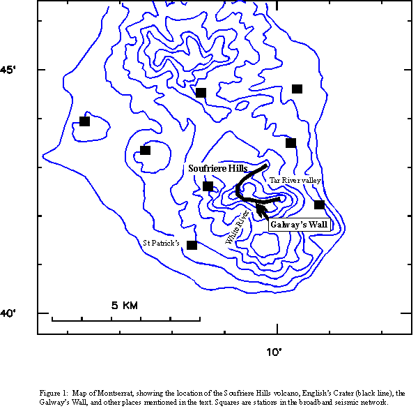
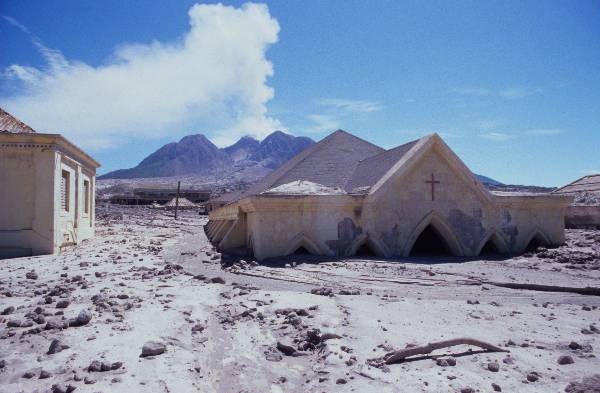
|
 1
1
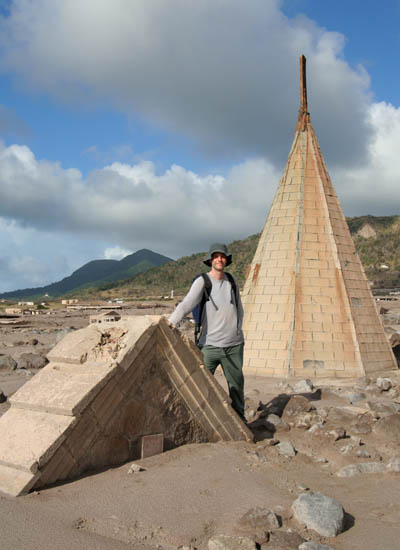
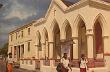
Fig.1 - Author by remains of
Catholic Church, Plymouth
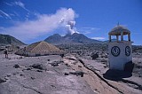
The Soufriere Hills volcano on
the Caribbean
Island of Montserrat has been
erupting since 1995. The most severe destruction occurred in
1997, when pyroclastic flows devastated large parts of the
southern half of the island, including parts of the capital
Plymouth to the W and various settlements to the SW, E and NE
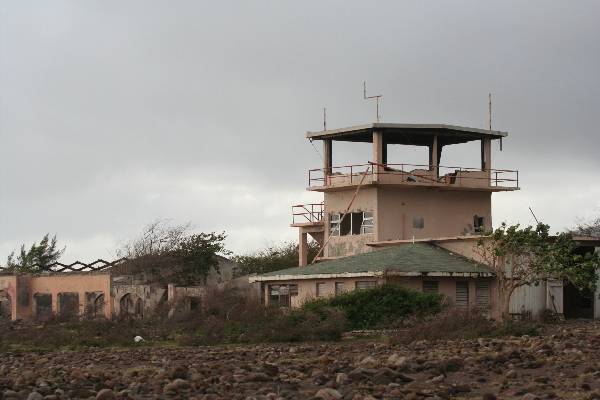
(including Bramble Airport). Many areas have also been
affected heavy ash fall and by lahars, including the remains of
the Capital Plymouth which are gradually being buried in lahar
deposits.
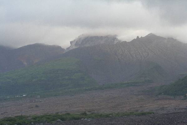
Eruptive activity
continues, with the volcano presently showing renewed dome growth.
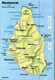
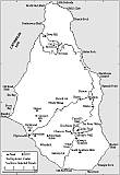
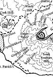
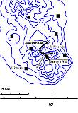
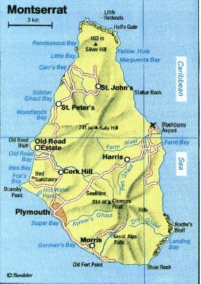
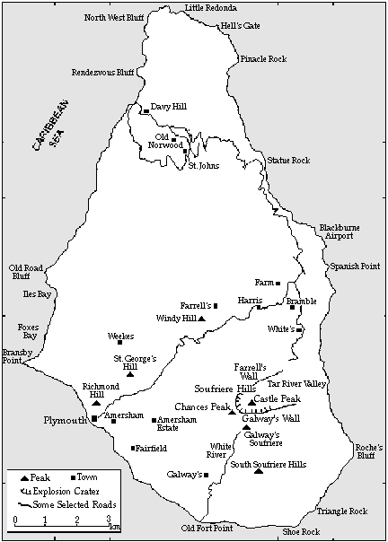
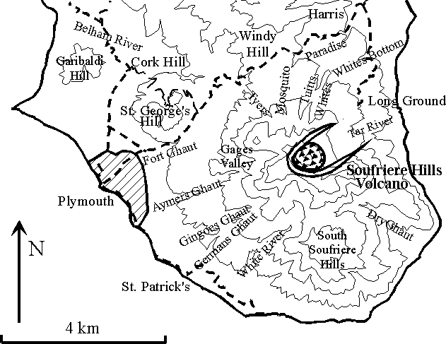
Maps for
orientation
Due to volcanic hazards, the
south of the island is designated as an exclusion zone.
Unauthorized entry into this zone is illegal (see Fig.2) and is
not encouraged by the author of this report.
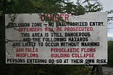 (Fig.2) (Fig.2)
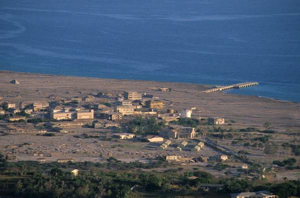
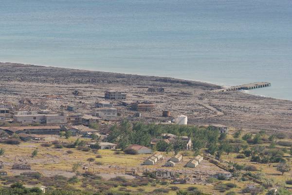
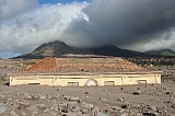
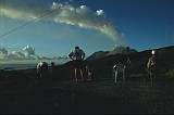
Garibaldi hill provides a good
view of the Volcano and Plymouth (Fig.3). The path of lahars
through the center of town is clearly visible. Fort Ghaut
river which flowed through the town has now been completely filled
with deposits. Lahar activity continues to bury the remains
of Plymouth as can be seen from comparable pictures of the town
center from 2002 (Fig.4) and 2006 (Fig.5). See most distant
part of town in pictures.
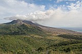 (Fig.3) (Fig.3)
 (Fig.4) (Fig.4)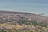 (Fig.5)
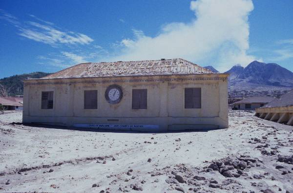
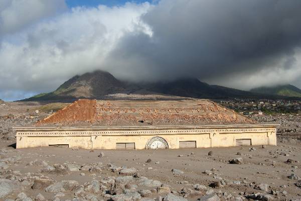
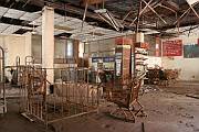
The burial of Plymouth is
further illustrated by the following pictures of the Plymouth
Court Building. The
next
picture shows the Court
Building and the Methodist Church (Fig.6 (picture from "Holiday
Montserrat 1993/94 Brochure)). The following pictures show
the Court Building in 2002 (Fig.7) and in 2006 (Fig.8).
 (Fig.6) (Fig.6)
 (Fig.7) (Fig.7)
 (Fig.8) (Fig.8)
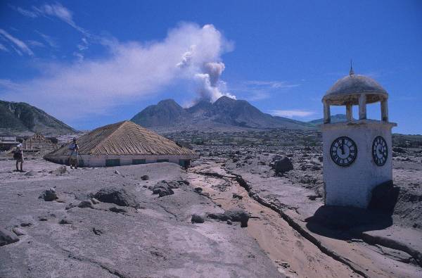
The following pictures show
the Methodist Church (Fig.9) and the War Memorial Clock Tower
(Fig.10) in 2002. Both have now been completely destroyed by
Lahars following the major eruption in 2003. Fig.11 shows
Letts Building (right) and Arrows Manstore in 2006 both of which
are partially burried.
 (Fig.9) (Fig.9)
 (Fig.10) (Fig.10)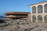 (Fig.11) (Fig.11)
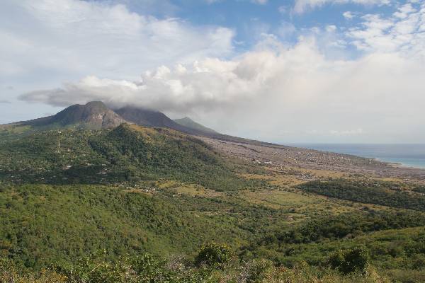
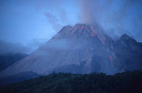
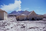
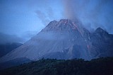
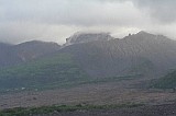
The dome is presently best
observed from the W side of the island. There is now a
purpose built viewpoint on Jack Boy Hill at the edge of the
exclusion zone. Fig.12 shows the older inofficial viewpoint
on JBH in use in 2002 with the large dome in the background.
Fig.13 shows the massive dome in Sept. 2002. The current
dome is growing in the crater left by the destruction of the
former dome in 2003 (Fig.14).
 (Fig.12) (Fig.12)
 (Fig.13) (Fig.13)
 (Fig.14) (Fig.14)
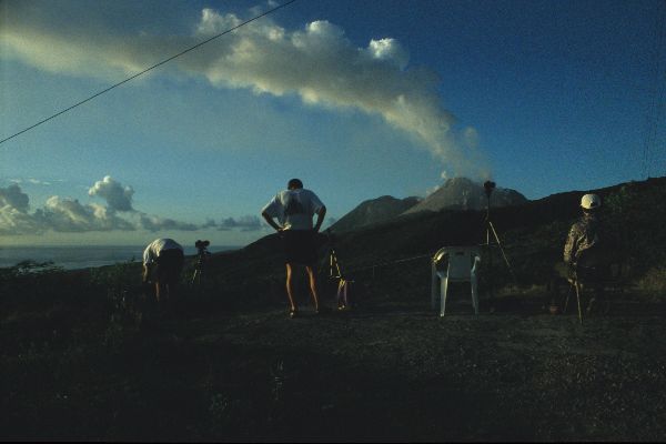
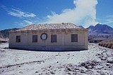
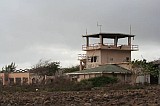
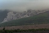
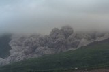
Due to the small size of the dome, it was
possible to visit the old Bramble Airport buildings (Fig.15).
These currently provide a good viewpoint for observing
pyroclastic flow
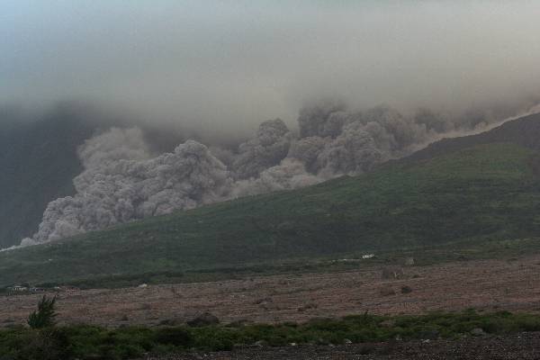
activity in the Tar River Valley. During a two day
observation period during unusually poor weather conditions, one
PF was observed (Fig. 16 and 17). This flow occurred on
20.01.06 at approx. 16.45 local time and extended over 1 km from
the dome which was not visible due to cloud cover.
 (Fig.15) (Fig.15)
 (Fig.16) (Fig.16)
 (Fig.17) (Fig.17)
 18 18
 19 19
 20
20
 21
21
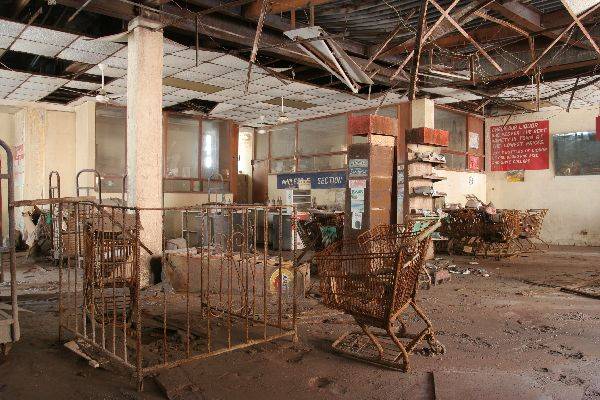
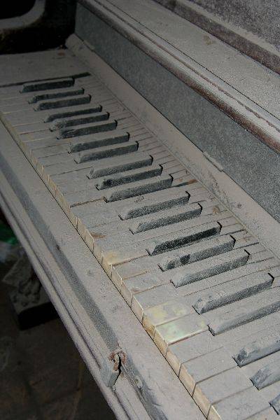
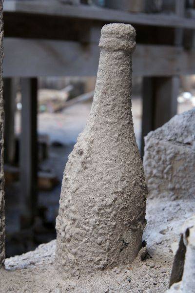
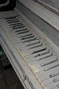
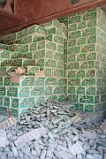
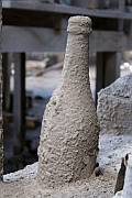
Silent
witnesses of the buried city
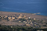
Travel Information:
Travellers to Montserrat should be aware that the only regular
form of transport to the island are Winair flights from Antigua to
the new Gerrards Airport (Situation in 2006). High winds and
heavy rain can lead to closure of the new airport which is located
in an exposed position on a hilltop. This can lead to missed
connections in Antigua, as I unfortunately experienced.
Low cloud is a more usual
problem on Montserrat. Best viewing time is probably March /
April. However, even then a week on the island can easily
pass without getting clear views of the dome.
More about at:
Photovolcanica.com

|